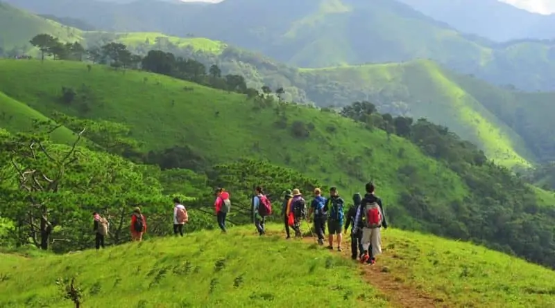
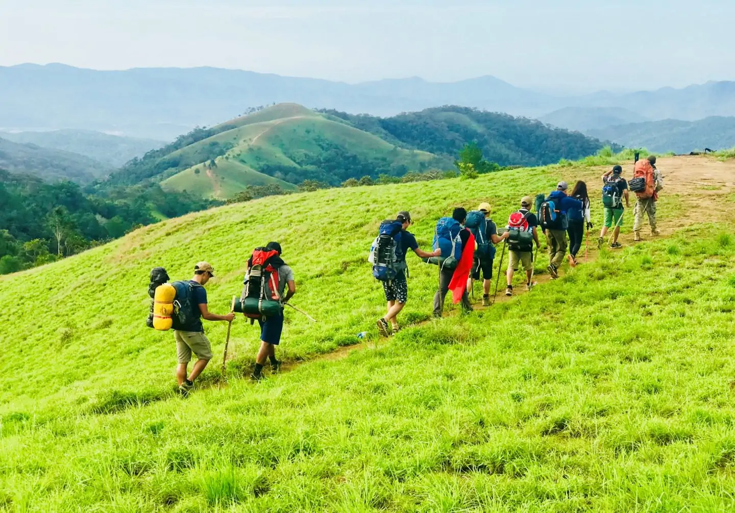
1. Overview of Trekking in Vietnam
Vietnam is famous for being a charming country and an ideal place to have great experiences on the journey to conquer the majestic nature. Possessing a diverse terrain and climate, trekking routes in Vietnam with “challenges” but also full of fun always attract those who are passionate about exploring and experiencing.
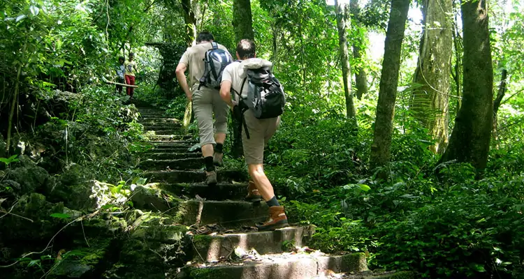
Trekking is a form of experiential travel that involves walking, exploring, and carrying things by yourself into the forest, mountains, or villages far from the center, with trekking routes that are often very wild but also surprisingly interesting.
The new form of trekking tourism was introduced to Vietnam not long ago and has a strong attraction for trekkers as well as tourists who love to explore. With its rich mountainous terrain, Vietnam has many challenging trekking routes for you to conquer and explore. If you are a person who loves to explore and adventure, do not miss the 10 best trekking routes in Vietnam below!
2. Discover the top 10 best trekking in Vietnam
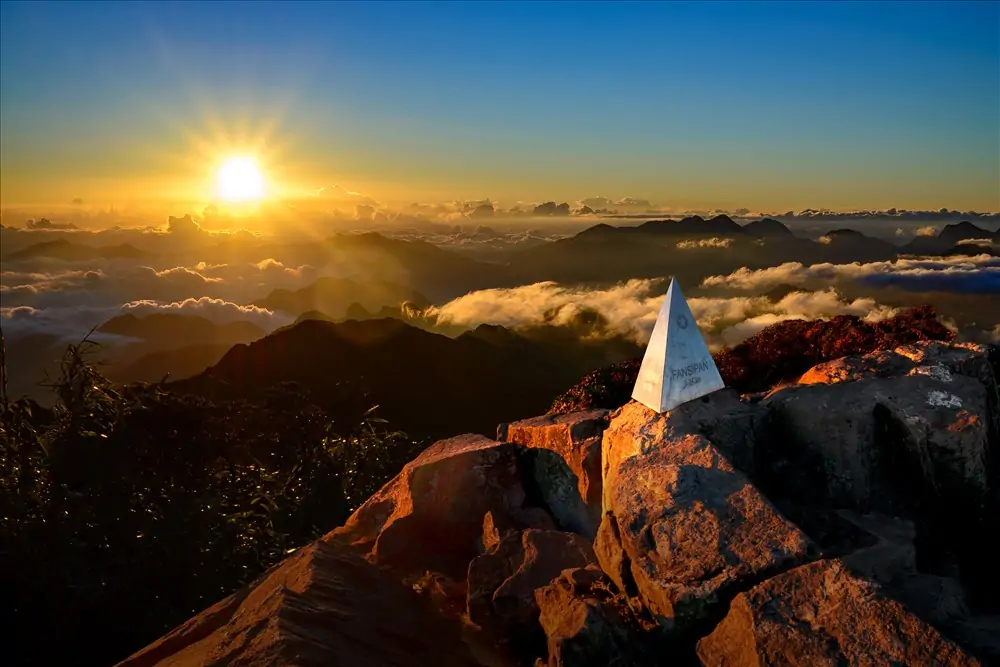
2.1. Fansipan – Roof of Indochina
With an altitude of 3143m, Fansipan is the highest mountain in the three Indochina countries, so it is known as the “Roof of Indochina”. Located in the Hoang Lien Son mountain range, Fansipan is about 9 kilometers from the center of Sa Pa town, bordering the two provinces of Lao Cai and Lai Chau. From the height of Fansipan, you can enjoy a panoramic view of the beauty of the Hoang Lien Son mountain range and Muong Hoa valley.


There are 3 routes that you can choose for this “Roof of Indochina” trekking journey:
- The easiest way is to start from Tram Ton to the top and return also this way. The duration of the trip is 2–3 days.
- Climbing road from San Sa Ho to Sin Chai village: This is a route with many high and dangerous rocky slopes, especially if going in the rainy season. It will take you 2 days, 1 night, or more to climb this route to the top.
- Climbing from Cat Cat Village: This is the longest route with the highest slope and the most difficult with very diverse terrain, but this route has the most beautiful scenery, with many azaleas. It will take you three days and two nights or more to reach the top.
2.2. Lao Than – Roof of Y Ty’s house
Lao Than is an ideal place that you cannot ignore on your next trekking journey. With an altitude of over 2800m, this place is covered by a dense layer of clouds, forming a poetic sea of clouds between the mountains and forests of the Northwest.
Lao Than is an ideal place that you cannot ignore on your next trekking journey. With an altitude of over 2800m, this place is covered by a dense layer of clouds, forming a poetic sea of clouds between the mountains and forests of the Northwest.
To be able to start the journey, you will have to move from Hanoi to Y Ty commune. Set foot in Y Ty commune, then move to the foot of Lao Than mountain, about 5 km away. Then go to the climbing meeting point with the porter, which is a very large vegetable farm at the entrance to Phin Ho village.
The road to the top of the mountain is not too complicated; it only passes through grassy hills and lowland forests. It only takes 4-5 hours to reach the resting place, which is a cave and empty land for the Mong couple who work here. And you should climb early to watch the sunset and continue the journey to the top of the mountain to catch the dawn and hunt clouds.
2.3. Apachai – The West Pole
Apachai is the westernmost point of Vietnam, located at the junction of the borders of Vietnam, Laos, and China. Apachai’s terrain is mainly dirt roads, mountain passes, and steep slopes that are difficult to navigate. So the right time to move from November to April every year is when the weather is quite favorable for you to enjoy the majestic natural scenery, where you can see three countries. Vietnam, Laos, China.
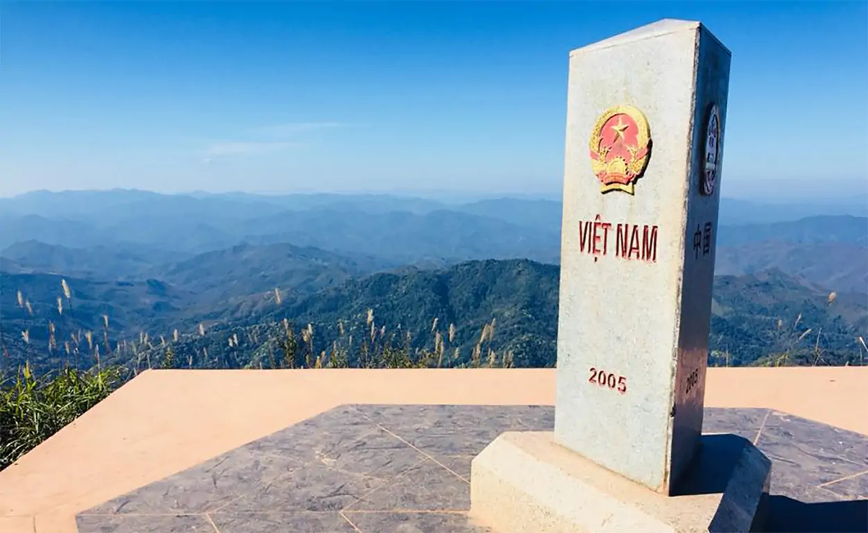
To be able to start the journey, you will have to move from Hanoi to Muong Ne, Dien Bien, and continue by bus, driving about 55km more to Apachai. After that, you make a trekking journey of about 3–5 hours to the Apachai landmark, located at an altitude of 1,400 m and made of granite with a square pedestal facing three directions. Each side is engraved with the country’s name in the national language and the national emblem of each country.
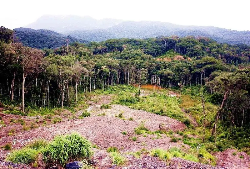
2.4. Cuc Phuong National Forest
Cuc Phuong National Park (or Cuc Phuong Forest) is a nature reserve and special-use forest located on the boundary of three regions of the Northwest: the Red River Delta and the North Central region of three provinces: Ninh Binh, Hoa Binh, and Thanh Hoa.
Cuc Phuong National Forest is located 120 kilometers south of Hanoi, deep in the heart of the Tam Diep mountain range. This forest has an extremely rich and diverse flora and fauna, characterized by a tropical monsoon climate.
The journey of trekking through the forest to Muong village (Khanh village), located on the poetic Buoi river with many traditional cultural identities, promises to be an interesting experience. If you want to make exploring Cuc Phuong Forest most enjoyable and complete, don’t miss trekking through the forest and camping overnight!
2.5. Cat Ba Island, Hai Phong
Cat Ba Island is the largest island in the system of 366 islands of the Cat Ba archipelago. Cat Ba Island (Hai Phong) is one of the ideal trekking spots in Vietnam. Cat Ba Island is located near the old, unspoiled forest of Cat Ba National Park.

Trekking in Cat Ba National Park: Hiking through the vast green forests is the perfect choice for visitors to fully admire the beauty of Cat Ba National Park.
Because of the increasing demand from tourists who want to trek through the forest, the management board of Cat Ba National Park has expanded many attractive trekking routes for visitors to choose from.
Some of the most anticipated trekking routes by tourists can be mentioned: the Ao Ech route to Viet Hai, the Kim Giao-Me Con route to Tung Di, and the May Bau route to Quan Y cave. Trekking can range from 4 to 8 hours, depending on the route. The above routes allow you to have the best overview of Cat Ba National Park.
2.6. Ta Nang – Phan Dung – The “national” trekking palace through the 3 provinces of Lam Dong, Ninh Thuan, and Binh Thuan
Referring to the most beautiful trekking routes in Vietnam, Ta Nang-Phan Dung certainly cannot be missed. The trekking route through the three provinces of Lam Dong, Ninh Thuan, and Binh Thuan is attracting explorers in the South. The starting point of Ta Nang-Phan Dung Palace is Ta Nang commune or Da Quyn commune in Duc Trong district (Lam Dong).
It takes about 2-3 days to go through more than 40 km of jungle, climbing passes, crossing streams, moving from an altitude of 1,100m to 500m above sea level. There are two different routes to conquer Ta Nang – Phan Dung.
- The first bow is more than 30km long, going mainly through hills and mountains, a few rivers, and streams, and takes 2 days and 1 night. At this palace, many people often choose to take the last 7km motorbike taxi ride instead of continuing to walk out; the price per trip for “Grab Forest” is about 6.4 USD for 2 people.
- The second arc is about 55 km long; on this route, you will pass through Yavly waterfall and many different large and small streams. It takes 3 days and 2 nights and is suitable for experienced trekkers. On the last leg of this journey, if you are too exhausted, you can take a motorbike taxi for the last 15 km to Phan Dung; the price is about 6.4 USD per person.
Looking down from above, everyone must be impressed with the magnificent landscape that nature offers this place, with rolling hills, cool springs, etc.
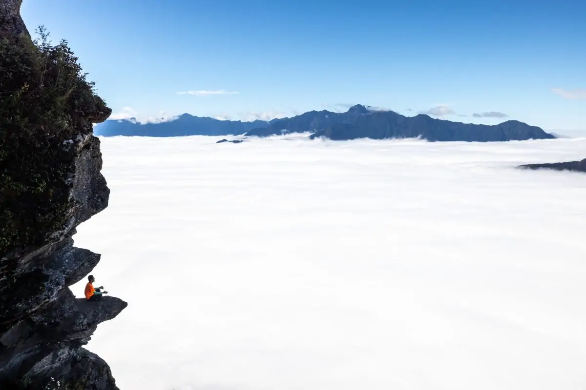
2.7. Bidoup – Roof of Lam Dong
Bidoup is the name of the highest mountain in the Central Highlands, located in Chu Yang Sin National Park at 2280 m. The top of the mountain is covered with fog almost all year, so the vegetation here is extremely rich and diverse.
Trekking conquers the top of Mount Bidoup; the 22km road passes from the temperate coniferous forest ecosystem to the humid temperate jungle. You will pass through the canopy of pine forests, through rivers and streams that are the source of the Da Nhim river connecting Lam Dong and Ninh Thuan provinces, and come to the primeval forest where the ecosystem is unique and diverse. endemic and rare flora and fauna.
Check in, camp, and BBQ at the top of Bidoup. Watch the sunset and sunrise on the beautiful mountain with many anecdotes and sacred historical events here.
2.8. Double Cape – Conquering the East Pole
Mui Doi belongs to Dam Mon fishing village, located in Van Phong bay, Van Thanh commune, Van Ninh district, Khanh Hoa province, about 80 km from Nha Trang city along National Highway 1A to the north, and Tuy Hoa city (Phu Yen) about 35 km to the south.
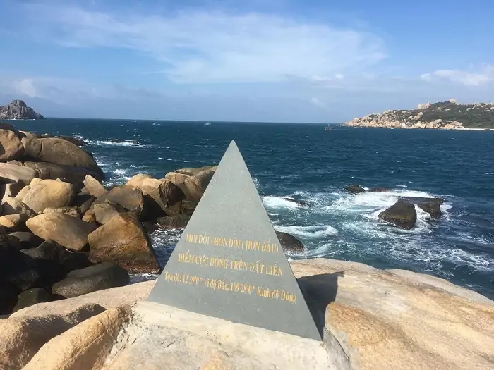
Trekking the East Pole: The first point on the Extreme East Trekking journey is that you have to go to Dam Mon first, no matter where you start. You can travel from Nha Trang, Tuy Hoa, or Saigon to Dam Mon by bus, then trek to Mui Doi and back to the mainland by boat, saving time, money.
Normally, the journey to find the first sun to rise at the East Pole would be complete in one day. If you want to fully enjoy the moment when the sunrise dyes the sea pink, you should camp and sleep here for one night.
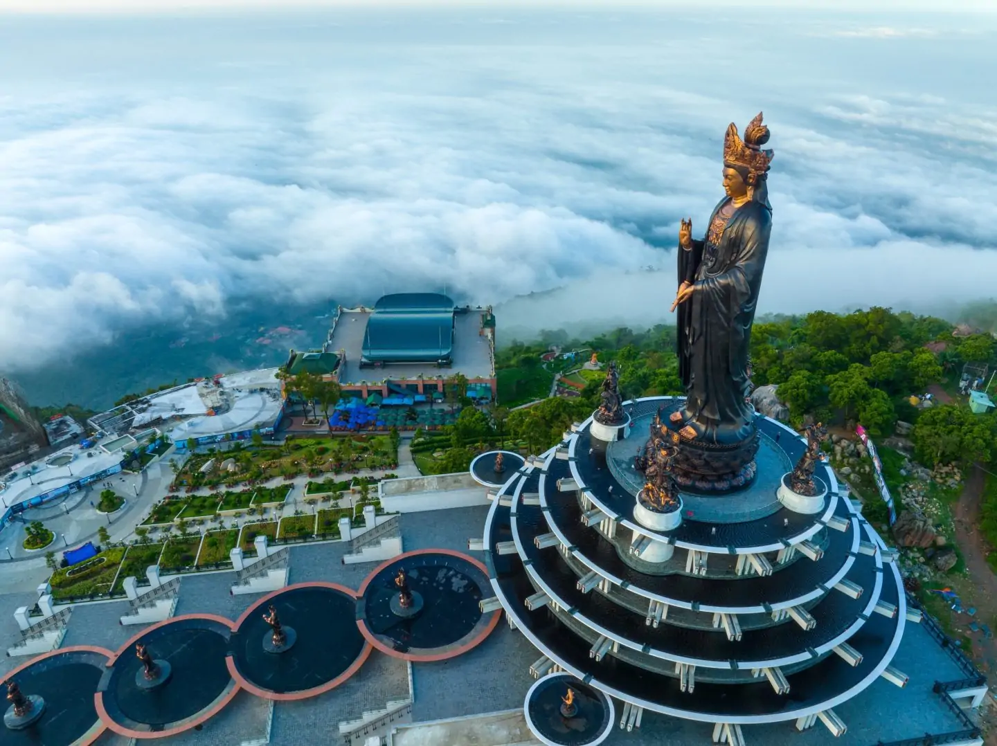
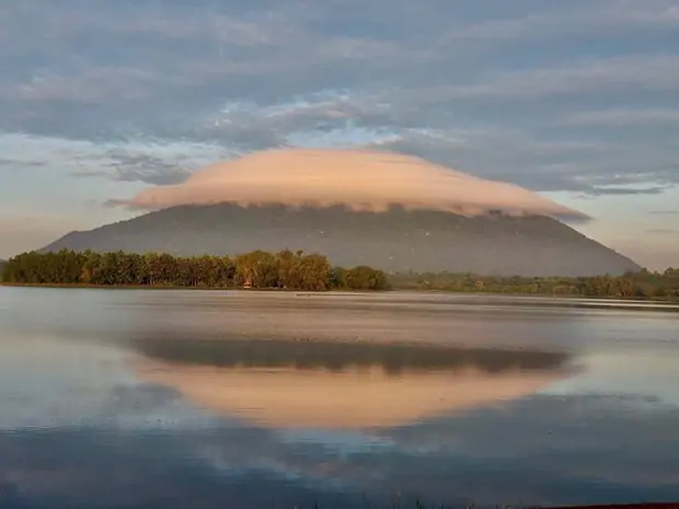
2.9. Ba Den – Tay Ninh
The most popular trekking route is Nui Ba Den, Tay Ninh. As the highest mountain in the Southeast with an altitude of 986m, 11km northeast of Tay Ninh City, Ba Den Mountain attracts a large number of adventurers to conquer every weekend.
Ba Den Mountain is located in the cultural and historical relic complex of Nui Ba, 96 km from Ho Chi Minh City. Nui Ba consists of 3 mountains: Heo Mountain and Phung Mountain, of which Ba Den Mountain is 986m high.

Ba Den mountain trekking and climbing routes, including pagoda road, electric pole road, water pipe, Ma Thien Lanh road, Phung mountain road, white stone road, and Ho Chi Minh road. Popular routes you can choose to trek are:
- Climbing Ba Den mountain, pagoda road: The pagoda road is located at the back of Ba pagoda and is considered the shortest but also steepest route to Ba Den mountain.
- Climbing Ba Den Mountain with Electric Poles: It can be said that electric poles are one of the most favorite roads of backpackers. There are also arrows on the way and numbered electric poles (from 1 to 117) leading straight to the top of the mountain. Climbing time ranges from 3 to 5 hours, depending on fitness.
- Climbing Ba Den Mountain by other routes: Ho Chi Minh Road and White Stone Road are two brand new names but have the highest difficulty. You should only go when there is a local guide knowledgeable about trekking and climbing in this area. Besides, the water pipe (in the back of Ba Pagoda), Ma Thien Lanh Street, and Phung Mountain Road are also very easy to get lost on.
2.10. Chua Chan Mountain – Dong Nai
Chua Chan Mountain (in Xuan Loc district, Dong Nai province), also known as Gia Ray or Gia Lao, is the second highest mountain in the South, about 110 km from Ho Chi Minh City. Chua Chan is also an ideal place to see the whole city or hunt for clouds and watch the sunrise the next morning.
After arriving at the foot of the mountain, you can choose 2 ways to climb to the top of Chua Chan Mountain in Dong Nai, as follows:
- Follow the electricity poles: Climbing Chua Chan Mountain along the electric pole is a road that people love very much. It takes about 2–4 hours to follow the power line. The path is also quite simple; you just need to follow the trail and look at the electric poles and power lines to reach the top of the mountain.
Climbing from the foot of the mountain to the top, you will pass about 145 columns. Note that the number starts at 20, but you only need to pay attention to column 145, which is the top of the mountain.
- Follow the temple path: Follow the temple path by taking the cable car up the middle of the mountain, and then you will be stopped at the temple area to continue walking to the top of Chua Chan mountain. Currently, cable car prices are calculated as follows:
Round trip fare:
- Children over 1.2m and adults are 7.7 USD/pax
- Children (0.9 – 1.2m) are 3.8 USD/pax.
- Children (under 0.9m) are free.
3. Notes before going trekking
Have good health and fitness.
You need to design a route and research the trekking terrain in advance.
Medical first aid kit: alcohol, cotton, bandages, antipyretic or pain reliever.
Survival kit: compass and paper map; whistle; flashlight; headlamp; multi-tool; water purifier; fire maker; survival bracelet.
Equip skills to effectively use survival items.
It is recommended to practice and remember trekking skills: stick resistance skills, balance skills, backpack skills when going downhill, and skills to properly allocate health when trekking.
For those of you who are inexperienced and taking part in a trekking journey for the first time, you should choose easy routes or choose trekking from tour companies that have designed a plan and have a guide to support you. Choose what’s ideal for you. You can refer to the Trekking Hanoi-Sapa 4N3D tour of Metta Voyage: https://mettavoyage.com/trip/hanoi-sapa-trekking/.
In the past, when it came to adventure tourism, people thought of it as only for certain tourists. Today, tour operators have designed flexible routes from easy to difficult, diverse in supporting the needs of visitors, etc. If guests are not strong enough to conquer the whole road, they can use the service partly with the support of “forest grabs”, wagons, and agricultural vehicles.
Visitors can completely focus on experiencing and exploring nature, and the risks compared to pure adventure tourism programs are also greatly reduced. Therefore, the current type of trekking tourism can satisfy the needs of diverse customers of different ages and professions.
4. Conclusion
In addition to the top 10 best trekking tours in Vietnam, our country has many other beautiful roads stretching across the S-shaped strip of land. Each route has its own attraction and interest. With many years of consulting and designing tours, Metta Voyage looks forward to accompanying you on every.
Contact us
Website: www.mettavoyage.com
Email: [email protected]
Hotline 24/7: + 84 989 383 572
0 Comment